

In last weeks post, I detailed how I was going to create a topographic map of Greece and give it to my girlfriend. I drew inspiration from a previous students work, found here.
The previous student was able to find a 3d model of a mountain range located in Estes Park. Since that area is heavily monitored by scientist and the government, there was a great deal of information about the topology available online. Since I’m recreating the entire country of Greece, I ran into a few difficulties. Originally, I thought I would be able to find a map of the country with contour lines and then transfer the lines into an .svg file for laser cutting. I was unable to find any accurate depictions of the country and its terrain, and only found something like this:

Art by HanSoloVive on Deviant Art
So I pivoted.
I found these two youtube videos, 1 and 2, and got to work.
I went to Google Earth, and was able to create a path that looked like this.
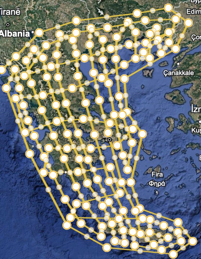
I then downloaded that information as a .kmz file, Keyhole Markup Language Zipped, and converted that into a .txt file.
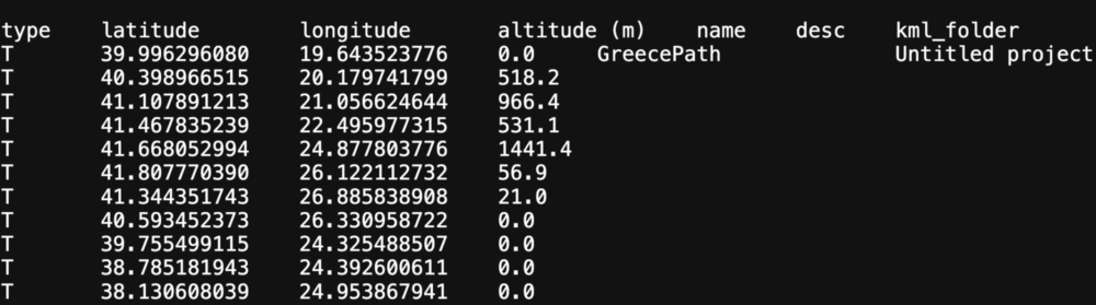
Using a software called QGIS, I was able to then convert that text data into a map with contour lines.


The first image is with 30 contour lines, and the second is with 20. You can see that as I add more contour lines, the shape of the country is able to become more clear. One thing I’m struggling with is that even with 30 contour lines, it doesn’t look all that like Greece if we’re being honest. On top of that, that means I’d have 30 layers of cardboard stacked on one another in the final piece and I don’t think that would be feasible with the imagined size of the project.
So where do I go from here ? I’m considering just drawing the contour lines myself in a program like fusion or rhino, and then laser cutting from there. I could place a map of the country with the terrain shown as a reference in fusion, and go from there. The thing is… That could take a few days and I’m not sure if that’ll be able to fit into the timeline for this project.
Sources
https://www.deviantart.com/hansolovive/art/Vectorized-Topographic-Map-Of-Greece-And-W-Turkey-853316850
All other images were made by myself and myself only. I credit Google Earth and QGIS as the softwares I used.
2 Comments. Leave new
I’ll second the other comment that the abstractness of these contours actually looks really cool, and I’m impressed by the code and research you’ve put into figuring out the topography. If you wanted it to look more like Greece, I would suggest that you need more elevation data points for the contours to follow. Is it possible to select more points on google earth or more intentionally follow the coastline?
Hi Rystan! I think what you’re doing is awesome and even if it doesn’t look a lot like Greece right now, I think you’ve done tremendous work so far. I also think it actually looks really interesting and Im not sure if you need it to look 100% like Greece, but this abstract view of the country is in my opinion also quite interesting. Good luck in finding what you are looking for!